Mae Ping National Park Through Its River, Forest, and Limestone Landscapes
A nature-focused guide to Lamphun’s river basin, woodland scenery, limestone features, and thoughtful northern park choices

A useful way to understand Mae Ping National Park is to follow the landscape’s changing relationship with water. In Li District, Lamphun, the Ping River basin links wooded hills, open water, seasonal forest, and striking limestone formations into one protected setting. The park is not defined by a single viewpoint or one headline attraction. Its appeal comes from the way these elements meet: river country gives way to dry woodland, reservoir scenery opens beneath ridges, and limestone shapes create a sharper visual contrast within the forested surroundings. This makes Mae Ping National Park a strong subject for readers interested in the Best National Parks In Northern Thailand, especially those who enjoy interpreting a landscape instead of collecting only famous stops. The guide below uses four natural lenses—water, woodland, rock, and seasonal change—to show what gives Mae Ping its identity. A short section also explains how the park can be presented within Chiang Mai Package Tours without allowing package language to overshadow the destination itself.
The Ping River Basin Gives the Park Its Sense of Place
The Ping River is the most useful starting point for reading Mae Ping National Park. It is not simply a water feature placed beside a forest; it helps explain the shape and mood of the surrounding country. River corridors collect movement through a landscape, create greener margins, and provide a visual line through hills that might otherwise feel enclosed. Within the park’s wider setting, the river and associated open-water areas bring breadth to views that would otherwise be dominated by woodland.
Doi Tao Reservoir is one of the best-known water landscapes associated with Mae Ping. Its broad surface changes the scale of the experience, giving visitors long views across water toward ridges and forested slopes. The scene can feel especially expressive when light shifts across the reservoir or when the outlines of hills become more pronounced in the dry season. For photographers, birdwatchers, and travelers who appreciate open horizons, this part of the park offers a different rhythm from a trail beneath a closed canopy.
The river-basin character also places Mae Ping within the history of northern settlement and movement without requiring a visitor to treat nature as scenery alone. Rivers support farming, travel, and communities, while reservoirs alter how people encounter an area. Observing the relationship between water, shore, woodland, and distant hills gives the park a geographical story. Mae Ping National Park Lamphun is therefore best understood as a connected watershed landscape, not merely an isolated patch of trees.
Seasonal Woodland Rewards Close Observation
Mae Ping’s forest character is closely tied to the seasonal climate of northern Thailand. The park includes dry forest landscapes, where trees, grasses, leaf litter, and exposed ground can create a more open visual texture than the evergreen mountain forests associated with some northern destinations. This setting has its own richness. Sunlight reaches the forest floor, trunks and branches form clear patterns, and the changing condition of vegetation becomes part of what visitors notice.
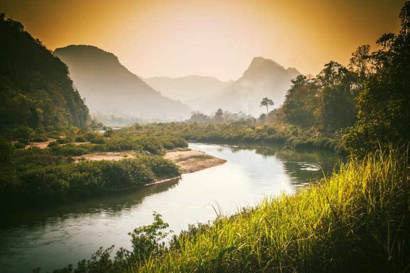
In the wetter months, rainfall refreshes the woodland and strengthens the colour of the landscape. Streams and shaded areas can feel more vigorous, while new growth adds density to the forest edge. The cooler, drier period often brings clearer views and a different palette, with fallen leaves and warm earth tones making the structure of the forest easier to read. These seasonal shifts are not a flaw to be managed; they are central to the identity of Mae Ping Forest Park.
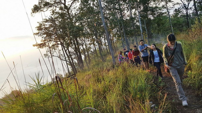
A walk through this kind of woodland is rewarding when attention is directed toward small evidence: leaf shapes, bark textures, insects, birds, animal tracks, and the contrast between shade and exposed ground. The experience is less about expecting one dramatic encounter and more about seeing how a dry forest functions as a living system. Nature lovers who enjoy field observation may find this setting particularly engaging because its details remain visible and legible.
Ko Luang Shows the Park’s Unexpected Geology
One of the most distinctive natural highlights linked with Mae Ping is Ko Luang Waterfall, known for its cascades and pale limestone surroundings. Water moving over limestone creates a visual character that differs from the dark rock and dense green often associated with waterfall scenery. The falls, pools, and rock surfaces make geological change visible at a human scale: a visitor can see how flowing water shapes, polishes, and separates stone over time.
The limestone formations also add relief to the park’s wider composition. Against woodland and hills, lighter rock surfaces draw the eye and give the waterfall area a strong sense of structure. In favourable conditions, flowing water and pools create an inviting focal point, while the surrounding forest keeps the scene connected to the larger protected landscape. Ko Luang is valuable not only as a place for photographs but also as an example of how geology can determine the character of a natural attraction.
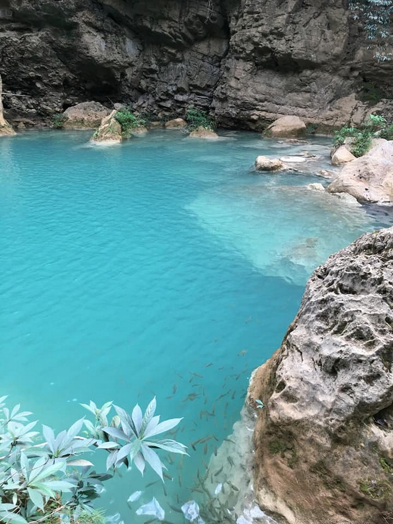
This combination of forest, water, and limestone is one reason Mae Ping National Park Thailand can appeal to travelers who want several forms of nature in one destination. The park does not need an artificial list of spectacles to be memorable. Its strongest attractions demonstrate processes: a river shaping a basin, rainfall renewing woodland, and water working through rock. That gives the visit an interpretive dimension suited to curious adults, families, and anyone who likes to understand what they are seeing.
A Park Best Experienced as a Sequence of Natural Textures
Mae Ping becomes more coherent when its features are mentally placed in sequence. Begin with the openness of the river or reservoir, where the eye travels across distance. Move into woodland, where the view narrows and attention turns toward leaves, trunks, and sounds. At a limestone waterfall, the focus shifts again to moving water, mineral surfaces, and the physical drama of a smaller space. Each setting changes the way the visitor looks, listens, and measures distance.
This sequence is also useful when comparing northern protected areas. High-elevation parks are often chosen for cool ridges, mountain panoramas, or cloud-forest atmosphere. Mae Ping offers a lower, warmer river-basin perspective shaped by dry woodland, open water, and limestone. The comparison is not a ranking exercise; it is a question of which natural story feels most compelling. Someone fascinated by watersheds and geology may respond strongly to Mae Ping, even if another traveler is drawn first to high peaks.
The park’s visual textures make it suitable for several kinds of visit without turning it into a crowded catalogue of activities. A landscape photographer can work with reflections, ridgelines, and changing light. A birdwatcher or plant enthusiast can concentrate on forest edges and seasonal growth. A family can use the contrast between water, trees, and rock to make a day outdoors more engaging for children. The common thread is active noticing: Mae Ping gives visitors material to interpret at every change of terrain.
Where Mae Ping Belongs in a Northern Nature Itinerary
For travelers searching Chiang Mai Package Tours, Mae Ping can represent the river-basin and dry-forest side of northern Thailand’s nature story. It is a meaningful choice when an itinerary’s theme includes protected landscapes, Lamphun’s regional setting, water scenery, and geological features. The destination adds substance to a nature-focused journey because its identity comes from connected environments rather than one isolated attraction.
Package language should remain secondary to the place itself. A well-shaped northern nature itinerary might use Mae Ping as the section of the journey devoted to reservoir horizons, woodland observation, and limestone water features, while other destinations serve different landscape themes. The name Maeping National Park may appear in package descriptions, but the important point is thematic balance: the destination contributes a specific ecological and geographical character that cannot be reduced to a generic forest stop.
Travelers considering a package can therefore judge its value by the attention given to the park’s natural story. An itinerary that leaves room to notice the river basin, woodland, and rock formations will communicate more than one that treats the destination as a quick name on a schedule. Operational details can change, so the final package description should be read for its actual route and inclusions; beyond that brief practical check, the central question is whether Mae Ping’s landscape is given enough presence to be understood.
Looking Ahead to Your Visit
Mae Ping National Park is most rewarding when viewed through a clear natural lens. Follow the Ping River to understand the basin, read the dry woodland for its seasonal detail, and pause at Ko Luang to see how limestone and flowing water shape one another. Those three perspectives reveal why the park belongs in any serious discussion of northern Thailand’s protected landscapes. For a visitor, the decision is simple: choose Mae Ping when the appeal lies in connected natural processes—water, forest, and rock working together—rather than in a single famous viewpoint. That is the park’s defining contribution to the region.

No comments:
Post a Comment